Hot Day Response activated @ 0911 by Chris Bigham
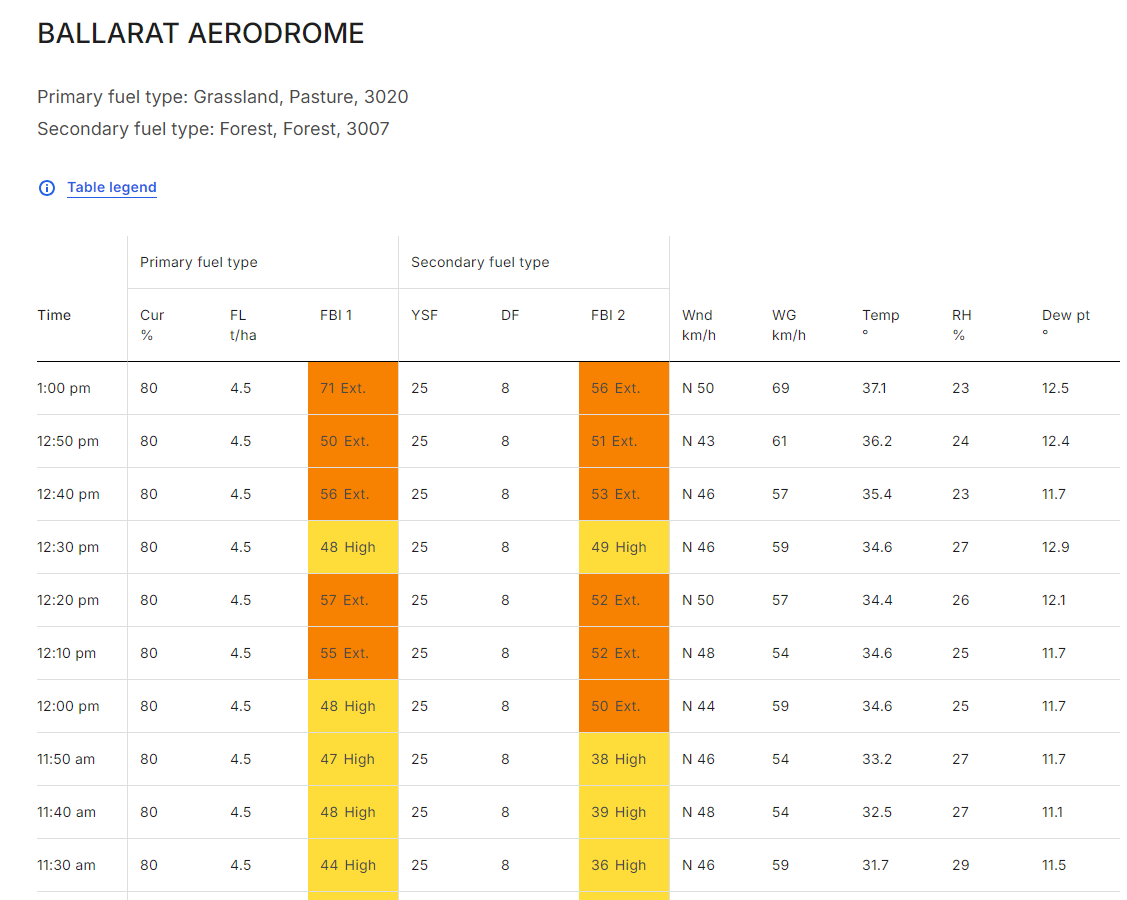
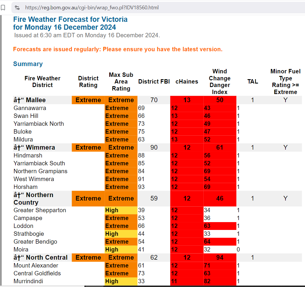
https://reg.bom.gov.au/reguser/by_prod/afdrs/#/vic/fire-weather-observations/89002
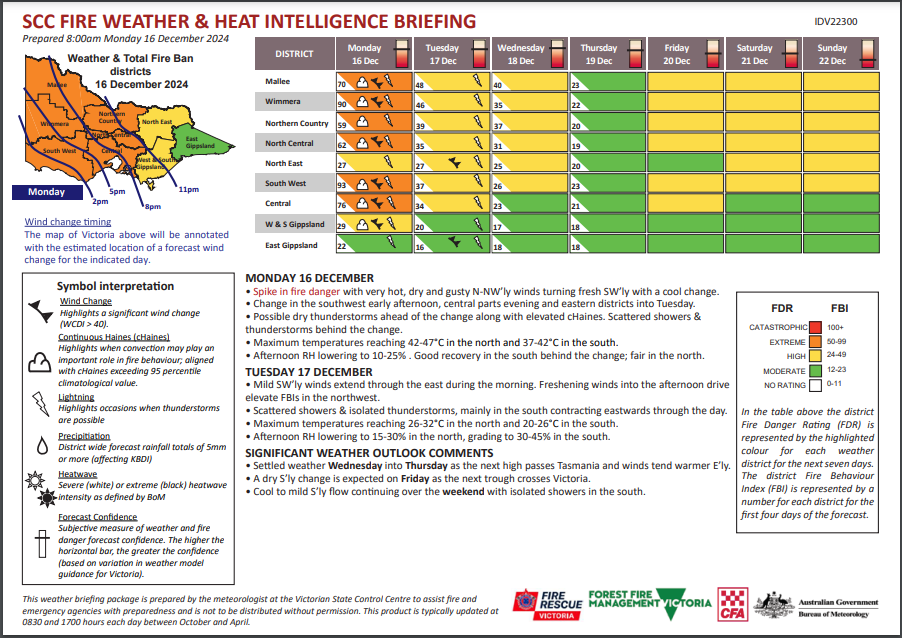
Mostly sunny at first, before cloud and isolated showers extend from the west during the day, mainly from the afternoon. Isolated high based thunderstorms ahead of the change will have little if any rainfall, bringing the risk of dry lightning, and the risk of damaging wind gusts. The change is expected to cross western districts during the afternoon and central districts during the evening. Moderate to fresh and gusty north to northwesterly winds ahead of a moderate to fresh southwesterly change. Very hot with temperatures well above average.


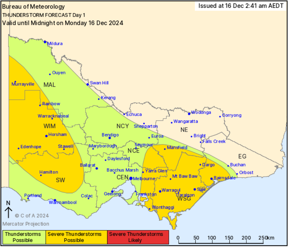
Issued at 2:41 am Monday, 16 December 2024,
Valid until midnight on Monday, 16 December 2024.
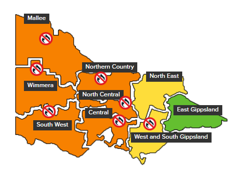
THUNDERSTORMS POSSIBLE (>10% of thunder within 10km of a point) over much of Victoria during Monday afternoon and evening across most of the western and central districts and parts of the eastern districts including all of West and South Gippsland. Thunderstorms are associated with an approaching front which enters western Victoria Monday afternoon and crosses central parts during the evening. LIKELY (>30%) thunderstorms over the far southwest of Victoria during the afternoon and evening.
SEVERE THUNDERSTORMS POSSIBLE (>10% if a thunderstorm occurs) over parts of the western districts including the Mallee, Wimmera, South West. Additionally a possible risk over West and South Gippsland and parts of Central, North Central, North East and East Gippsland districts. Most likely to occur during the afternoon and evening in both areas. Thunderstorms more likely to be high based and dry.
HAZARDS: DAMAGING WINDS are possible with any thunderstorms.
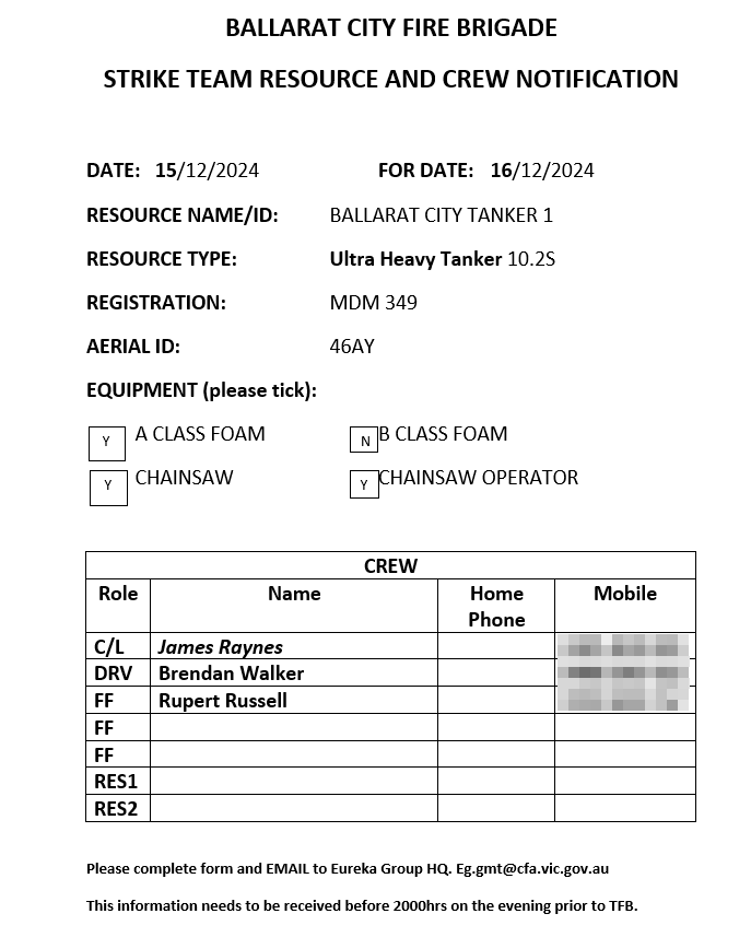
Turnout 1715
return 2317
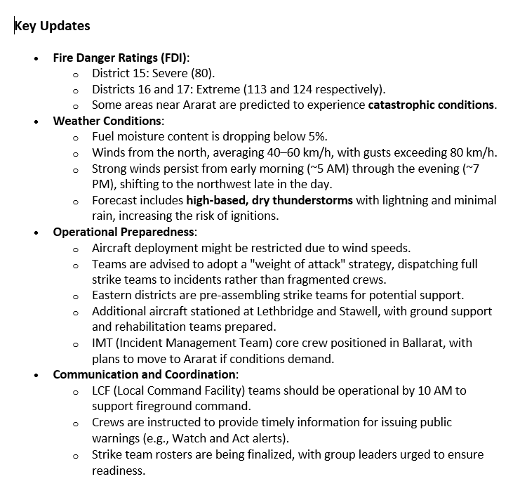
Key Updates
